Savanna Studio Recipe

Mix, but do not shake:

36 students armed with sketchbooks and camping gear

3 instructors prepared with information and an agenda

5 university vans equipped with walkie-talkies and spare keys

Then add a plethora of interesting historic, cultural and native landscapes over 7000 miles, and you have an adventure to remember!


Wednesday, September 29, 2010

Day Thirteen | Partners Through Places and Blogs

Lower Falls
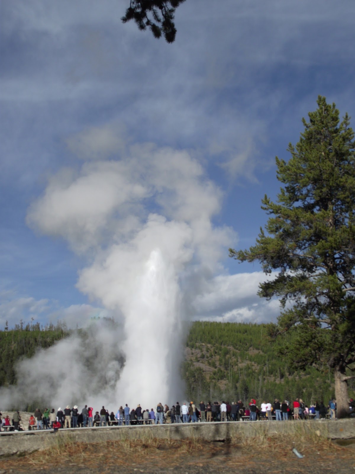
Today we got our 7:00am wake up call.  A quick bite to eat and we loaded the vans around 8:00am. We headed into West Yellowstone on our way to the Lower Falls. Today, Kaspar and I were assigned to begin our Place Project, part of which includes a photo collage that shows the experience we had in the space, so we had to take a lot of photos. When we first arrived, the overall beauty of the place took us back. A mist came up like a cloud from the bottom of the canyon and the sun was casting shadows on the canyon walls. Gary had us do some two minutes sketches of details from the canyon walls and water at Artist Point. When we finished our detail sketches we were given ten minutes to do a sketch of the entire Lower Falls and lower stream. It was so relaxing sketching and the weather could not have been more perfect. 


Lower Canyon
After sketching, we left on our six-mile hike on a loop near Lower Falls. Our first stop was Ribbon Lake where we wrote haikus about the area. It was remote and absolutely breathtaking. You could see the sky and trees reflecting in the water. After a much-needed lunch and a back woods potty break, we continued on our journey through more remote landscape.


Ribbon Lake
We reached the thermal pools, which put off a strong smell of sulfur. They were a very vibrant aqua color. We spotted our first bear track, which was very exciting for all. Everyone was running low on water and the hike was getting long and tiring. We stopped by Clear Lake and we put our sore feet in the cool blue water. It felt so good after being on our feet for such a long time. When we left the pool we walked through a wasteland that was white and smoky. We continued up the path towards the Lower Falls and Artist Point where our journey had begun. After a few more photos we headed back to the vans.

Clear Lake


Our day ended back at our West Yellowstone hotel.  We all packed our stuff to get ready to head to the Tetons and another campground.


Brittany Morrison and Kaspar Musteikis


Day Twelve | Geyser Graphics 101

...and again in 90 minutes
The morning of September 24th started out a little differently than most.  Each student was scheduled to have a sketchbook review with one of the professors between 8:00am and 10:00am before leaving West Yellowstone in Montana to visit Old Faithful inside Yellowstone National Park.  The sketchbook reviews were meant to help the students check up on their work and to discover ways they might better their drawings and writings.
Leaving for Old Faithful we were again greeted with beautiful weather and the sun was chasing away the morning chill.  While driving through Yellowstone, vast amounts of steam could be seen rising into the bright blue sky from the numerous geysers dotting the landscape outside the windows of the vans.  Other park visitors this morning were slowing traffic as they stopped along the road to view and photograph trumpeter swans, bison and elk. 
Nick's Composite and Watercolor
We arrived at Old Faithful and gathered outside the Old Faithful Inn for a brief lecture about the history of national parks in America. We were then assigned a project analyzing details of landscape design and architecture throughout the park. These included screening, use of native vegetation and materials, low silhouettes with a strong emphasis on the horizontal, elimination of straight lines and right angles in the landscape, blurring the line between indoor and outdoor, scaling materials to one another and to the place, using rustication as opposed to clean finished details, orienting stone as it’s found in nature, and eliminating lines of demarcation between nature and man-made structures. We then dispersed and searched for six examples of these details around the park. Our assignment was to create a two page spread in our sketchbooks with a map of a small area of the park in the center. We then sketched these six different details and laid them out around the map, indicating where in the park they are located. The finished result was composite drawing of parkitecture around Old Faithful that clearly expressed the details and showed where one could find them on the map.
We all scream for ice cream!
After we completed the project we were given an hour to compose a sketch using a medium of our choice. Several students chose to do watercolor while others used pencil or pen. Our time at Old Faithful flew by and we quickly found ourselves laying down our projects at the site of our meeting earlier that day. I always find it interested to see so many unique approaches to the same project, and much of the work was quite impressive. After a long day of hard work some of us made a brief pit stop for ice cream before meeting back at the vans. We traveled back to the hotel and spent the evening exploring the town and buying sweet wildlife shirts, a fitting end to the day.

Nick Gulick and Jordan Garvey


Day ELEVEN | Take Nothing but Photos - Leave Nothing but Footprints


Roosevelt Arch
Today we woke up to yet another 7am wake up call. After struggling to get out of the warm bed and amuch appreciated shower, a continental breakfast was next on the agenda. Following breakfast we headed downstairs to the hotel conference room to present our site intervention projects on Cody, Wyoming from the previous day.  Twelve teams of three presented twelve different ideas, all of which were unique. The designs included arches, bridges, tunnels, imitation geysers, and even a mustache themed welcome sign, to which Gary responded "Its all about the 'stache."  Overall the presentations were well thought out and went well.  After two hours of presenting, it was time to get in the vans and begin the day at the north entrance of Yellowstone National Park to talk about and sketch the Roosevelt Arch. While at the arch we discussed its history and namesake.  Michael Martin presented the information and briefly touch on "parkitecture."  We concluded our visit to the arch with a 30 minute sketch of the impressive structure.  A phrase found commonly in the park, "Take Nothing but Photos and Leave Nothing but Footprints," asks that we do not remove anything from Yellowstone National Park, and that we do not 
leave any garbage behind.  

From there we caravanned our way to Mammoth Hot Springs.
Mammoth Hot Springs
we arrived we identified some animal droppings with Julie's help.  Michael Martin suggested Julie teach an animal dropping identification course at ISU.  His idea was quickly shot down.  There were an abundance of elk and by looking at the ground it was very apparent. In fact it was quite difficult to avoid walking in elk droppings if you made the mistake of cutting through the grass instead of taking the less sidewalk.  After some packed lunch and a variety of ice cream flavors including moose tracks from the local gift shop, we sketched the nearby former military buildings and Gary gave a brief history lesson on the different styles of architecture found in the former military installations.  While sketching there were several sightings and encounters with elk who were grazing on the grass throughout the buildings.  Once we were finished with our sketches, we walked over and water colored the hot springs. We started with a brief lecture from Gary on the causes of the various forms of the springs.  The hot springs presented a difficult challenge because it was the first time that we had encountered water in a watercolor. Many students were frustrated with their finished products which was apparent by comments made at both the hot springs and the review which we call a 'lay down'.  (Mostly sarcastic remarks were made on the quality of work by the students.)  After the lay down we loaded up the vans once again and headed out.  On the way back to the lodge we had quite the adventure.  Between the 30 minute construction waits, the frequent bison crossings, and the bear sighting, it took a while to get back to the lodge.  After a very brief discussion most of us decided it was time to do laundry.  So we once again loaded up a couple of the vans and after several rolls of quarters and a few hours of waiting, we finally had clean clothes to wear. By that time it was time to go to bed.
'BisonJam"
                                                          
Alex Gartner and Matt McCoy


Monday, September 27, 2010

VIDEO | Under the Bridge


Here is a brief clip of Heidi Hohmann's lecture under the bridge on a rainy day in Minneapolis. The Students thoroughly enjoyed Heidi's talk and the urban hike around the river!

Thursday, September 23, 2010

Day TEN | Three states in three days!

Buffalo statue in Cody, Wyoming
Larry Pirnie, Evening Run
Our first and last wake-up-call in Cody, Wyoming. The plushy beds felt wonderful to sleep on after 5 nights of curling up in our sleeping bags in the Badlands and Black Hills. After realizing our breakfast was not in our hotel, we venture across the frigid parking lot to find our meal waiting for us in the back of an antique store. We ate breakfast with a buffalo head on the wall staring back at us. At least we were eating bagels instead of buffalo…that would have been awkward. We loaded up the vans and got ready for our first assignment of the day…DESIGN INTERVENTION. We were divided into groups of three and told to explore the town of Cody, because we were to design a gateway connecting the historical museum to the visitor center.
After taking numerous notes and plenty of pictures we met up once again before beginning our design task. Cody is a huge tourist town; Buffalo Bill had left his mark on almost everything in the area. We sat outside working on sketches, and some groups found clever ways to escape the cold, such as working in the hospital and even inside a nearby teepee. Two hours later, after freezing to the bone, we stopped the project to warm up and look at the landscape artwork in the historical museum. The art depicted landscapes of Yellowstone, and of the cowboys that made that rugged land home. Work of those like Larry Pirnie and Carl Rungius lined the walls of the gallery.  Along with the paintings there were sculptures of Native American art scattered throughout.  The many works were both beautiful and inspiring. Just before heading out on another road trip we stopped for a grocery run.  On our drive through the mountains we encountered sunset, rain and…snow?!  We arrived in West Yellowstone, Montana just in time to spend the rest of our free night working on our design intervention projects.  A hotel lobby can look pretty full with 30+ LA students sprawling their sketchbooks and drafting tools everywhere. The night was spent preparing for the next morning’s presentations.
      
                                                                                                                               -Devon and Kathleen

Wednesday, September 22, 2010

Day NINE | We Crossed Into Wyoming and I Didn't See the Sign (I Was Driving)


Another early wake up call saw the studious Savannah travelers off into the frontier lands that are now called the western United States. After a few hours on the road we stopped to see the Mateo Tepee (Devil's Tower) and stared in awe at it's geologic brilliance, of course while doing a watercolor. Soon after we were on the road again surrounded by the ever shortening grass of the western plains. Everyone in the vans were awoken in the grand city of Gillette, Wyoming for a scrumptious non camping meal of healthy foods such as McDonald's and Wendy's. The vast emptiness of the Wyoming plains was soft rolling hills that seemed to have put everyone in the vans asleep except for us, and of course the drivers. With only the occasional Pronghorn to spark our interest it seemed like quite some time before we actually reached our next destination up in the majestic rocky mountains. Our stop, Medicine Wheel, was located on the top of a mountain, and we could not have arrived there at a more pristine time. It was a mile and a half walk up to the summit and you could feel the burn in your legs. Medicine Wheel is 90 feet in diameter and is placed 9640 feet above sea level. It has been dated back to at least the year 1760 by a piece of wood that was found there. There are skulls of majestic animals placed within the wheel. It is believed that this site was once used as a gravesite for the greatest tribal leaders. It was magical being so far up surrounded by so much solitude. Some people have speculated that the medicine wheel was also used as a sort of observatory by some. This seemed possible and there is one extra "spoke" on the wheels that matches up with the research. A fence has recently been placed around it because of its importance to Native American spirituality. Many offerings were located up there on our visit, including; dream catchers, prayer ties, stones, and tobacco which were for the males.
The prayer ties were in different colors. We learned that the different colors represent the cardinal directions. North was white, south was black, west is red for the sunset, and, for the sunrise in the east, yellow. The timing and the view were breath taking from Medicine Wheel because the sun was setting just as we reached the peak of the mountain. This made for a chilly walk back to the vans and an even more interesting drive to Cody in the dark down the mountainside. We had the opportunity to deal with a 10% grade over a length of 14 miles, which is rather exciting when it is dark out and you are riding in 15 person vans! Going first and second gear the whole way down was precarious, but we made it safely to the bottom and coasted the rest of the way into Cody, Wyoming. Arriving in Cody sometime after 10pm at night and finding it to late to do laundry at the local laundromat, the dirty, travel weary Savannah students from ISU retired to their rooms to gear up for another day.

 Kaci Cooper
Nick Lyon

Day EIGHT | You LEAD, I'll follow...

Ni hao ya’ll. The eighth day of Savannah Studio started of with a blazing hot lecture on the regions of the Black Hills. My favorite was the Hogback Rim! We also learned why the Black Hills is referred to as the “Cross Roads” and how the plants migrated there.  The “Cross Roads” consists of vegetation from the Mountain Forest to the west, the Boreal Forest to the North, and the Eastern Deciduas Forest.

Before we headed to Lead, we stopped by the Visitor’s Center to learn a little more about Custer State Park.  What a classic example of big stick architecture! Besides just learning a little about big stick architecture, we learned about the different rock formations and the different mammals that the park holds. Did you know that you could make rattles out of buffalo scrotums? The park supports 950 buffalo in wintertime. That’s a lot of rattles! After this great discovery we loaded into the vans to head to our destination of lead for the day.

We pulled into Lead around lunchtime. Lead is a quirky little old-fashioned mining town with a lot of friendly people. Lead’s main street shows how the town was once an industrial mining town and has slowly diminished. There are several storefronts closed, but there is hope in the aspect of a tourist attraction.  As of right now they have a look out, two gift shops, and a tour trolley.  Like many small towns there is always a great little sit down place to eat; if you haven’t eaten at the Stampmill, then you’ve never lived. They make a mean cup of cottage cheese and hamburger.

After lunch, we were set free to work on our colored pencil drawings and vignettes. This was an interesting new concept, that helps show the emotional feel of the town in our drawings. We all looked like straight ballers laying down our sketchbooks right off Main Street, PRAIRIE STYLE.

Our day began to wind down when we headed over to Keystone to grab some pizza, courtesy of Iowa State and our instructors. Nom nom nom. We made short work of the pizza, and a few of us even tried some buffalo meat on it. By short work we mean we sat down, devoured 10 pizza’s, and were on our way again in 30 minutes! Many of us were not quite full yet, but we were not complaining. Pizza was a great change from the usual camping foods of caned foods or pop tarts which some preferred.

“I love the way you do it right thurr.” –Chingy

By: Michael Buh and Sam Christensen

Day SEVEN | Sunday Funday!


A lone Ponderosa growing atop the second tallest peak in South Dakota.
            Today was the Savanna Studio’s first free day. It happened to be our first full day in the beautiful Black Hills, and we had the whole day to roam the campgrounds. We woke to a blanket of fog surrounding the campsite as well as the usual 40-degree temperatures we have become accustomed to. After discussing our optional activities for the day, we went in different directions, scattering to the four winds you could almost say. One group of students went to Mount Rushmore and drove the Wilderness Loop with Gary.  Others chose a more active alternative, when they chose to hike around the campsite and nearby babbling brook instead. Others went to Rapid City for a more practical free day (to the chiropractor!). The majority of people however went on a hike to Harney Peak, the tallest point in South Dakota

Life is good at Harney Peak... good enough to nap for some!
            Ryano: The group that went to Harney Peak drove for about 30 minutes along a windy road and tunnels with three inches of clearance on either side.  The morning trip was worthwhile. Just as we had parked at the trailhead, we were showered in sunlight and heat. This inspired many of the students to disrobe numerous articles of clothing.  Once the sweaters, long sleeved t-shirts, and even a good number of t-shirts were shed and packed away, the hike began at a brisk pace. As we stretched into a long chain of sun loving student hikers, we quickly realized the inverse relation of elevation, and cardiovascular stamina. Even out of breath, all of the students were inspired to make it all the way up to the Harney Peak, by the occasional glimpse of the hollowed out fort located atop the peak.  In addition to the view of the peak, the hike was full of stunning vistas from rock outcroppings and breathtaking views looking over cliffs from which many sketched, others had lunch, and one especially exhausted student slept.  Although there was an unfortunate misadventure later on in the day when a couple students got lost, most all other hikers have decided that it was a great day.

A couple of particularily ominous tunnels
Paige: I however did not enjoy any of these activities, but instead my parents came to visit me! They came all the way from Colorado to enjoy the sunny Sunday with me. I was woken up abruptly at 7:15 by the sound of my mom’s voice through my tent. Quite loudly I might add. We quickly set off to breakfast at the lodge and then started on our jaunt up the Needles highway. The aptly named road took us through beautifully scenic rock formations. The rocks were stretched tall almost as if they were laffy taffy. The road wound back and forth with several heart stopping one-lane tunnels. Almost all of them had a blind curve so we had to honk to make sure that no one was coming from the other direction, and more than once we had to back out to let another vehicle pass. We quickly came upon the Mount Rushmore area approaching from the backside. As we rounded a corner we could suddenly see the side of George’s face. We did not stop and go into the park but instead did a drive-by due to limited visit time. My parents soon dropped me off at the campsite and I spent the rest of the day leisurely studying and sleeping, but not eating, since I accidentally left all of my food in the vans, which were otherwise occupied (see above activities)
One of the many blind corners of Custer National Park

Overall, we students enjoyed our free day a great deal.  In fact Paige and I have decided that the most appropriate title for the collective outing is Sunday Funday--more than that, it has been the best day of the trip yet.

Day SIX | The Black Hills Have Eyes


Day six of Savanna Studio we woke up to a blistery cold morning. The day a head was filled with a long drive and an eye opening visit to the Wounded Knee site. The weather was a cold and misty which made our lovely morning lecture feel like a 3 hour statistics class. Short after we all gathered into the vans and headed out for the days seven hour drive to Custer State Park. The drive was rather event full, in van Lamb chop we got to listen to the one the only Micheal Marten iPod remix. The drive sure didn't seem as long as it sounded the amount of fun naps and reading made time pass. The first stop on the trip was Pinelake Reservation it's very large sum 100 miles wide by 50 miles long. The reservation hosts the site of Wounded Knee where we got the wonderful experience to meet Kathy Elk and listen to her eye opening stories. 
We learned that most of the reservation doesn't even have jobs sum 80 percent does not have  and one the other 20 percent have part-time jobs. Kathy explained that that people don't have anywhere to go to get away and the younger generations are turning to drugs and alcohol to cope with there situation. The Wounded Knee burial site was hard to enter because of the amount of somber and death that occured there. The site was almost hard to enter because we did not want to disrespect any of the Lakota people. 

After the visit we drove to Pinelake where we had a classy lunch a Taco Johns and bought groceries at the local market to help stimulate the economy. After the Wounded Knee experience we headed out to the Custer State Park. Upon arrival at Custer State Park was a foggy day so a whole lot wasn't seen.  The arrival at the State Game Lodge Campground was very foggy but we had a great camp site right next to a creek. After camp set up and dinner we had a kumbaya moment with Michael and the whole gang sang the night away. After the cold set in for the evening everyone scattered to there warm sleeping bags dreaming of the next days events.


Over and out, Jeff Boyum and Yuqiu Hong

Saturday, September 18, 2010

Day FIVE | Scaling the Wall

We awoke on Friday, the fifth day of Savanna Studio to an eery landscape covered by a surreal-looking sky; we were still in the Badlands, SD, and there was much to be done. The day began with a short breakfast, after which we hurried to fill the vans. We drove first to a place where we were able to look down upon the Badlands and study the complexities of its many ravines and the separate levels of rock of which it was composed. One of the things that stuck out to me as very bizarre was how these massive rises and drops in the landscape were made not out of solid rock, but of sedimentary rock.
white river valley overlook
As we looked down into the expansive gullies, we were instructed to draw a topographic map of what we saw. Essentially, we were drawing the changes in elevation using contour lands, which was a new concept to many of us. We then drew a section of our maps, cutting right through it and showing the rising slopes from an entirely different perspective.
the wall
After this drawing exercise, we decided on an early lunch, and headed back to camp. We tried to keep it fairly short, because we knew that we would be hiking directly afterwards. As it turns out, we would be hiking what is known as “the Wall”, which is a dramatic change in elevation that separates the Badlands into two different areas. The hike was rough for many of us, but it was also a lot of fun. Some of the more adventurous hikers would attempt to climb the highest peak they would see, and they were rewarded with beautiful views.
When we all reached the top, we explored the vast prairie that lay there. We saw familiar and exotic plants alike, and drew several quick sketches. Personally, this reminded me a lot of the plant walks we would take back in Ames, but the view that lay beyond the prairie was exponentially more breath taking.
lunch time!
            After hurrying back down the wall and checking out the visitor center, there was only one thing left on the agenda for the day. We piled back into the vans and drove to a place Gary had in mind for our colored pencil drawing. When we arrived, we walked a ways through another complex canyon into an area with an astounding view. Personally, I hadn’t attempted to draw with colored pencils since I was very young, so I thought it would be quite the challenge. I was surprised to see that the drawing came much more naturally than I had thought, and I was very impressed to see everyone else’s when we laid them all down as we left.
color pencil drawing spot


            We all knew that it was our last day in the Badlands, so after dinner, many of us rushed off to climb whatever cliff looked the most dangerous. It was quite the experience, and some of us came back with wounds to prove it. Those of us that had gone returned to camp to bad news; it had become very windy, and some of the tents had begun to fly away.
As the evening went on, more and more tents were taken down, and we knew that it would be a pain to try fitting everyone into the tents that remained. As a matter of fact, it was so windy that it was as much of a pain to cram everyone into the tents as it was to walk around outside! This made for a very uncomfortable last night at the Badlands, but we had had such a great time there that it was hard to dwell on.

- Written by Sam Kirchner, with pictures by Qiyi Li

Day FOUR | How About 25 Cents for a Pheasant?

600 miles and ten hours later, we have arrived in the Badlands.  The landscape has quickly changed from towering crop fields to endless hills.  While in the van, we read articles about glaciers, the geography of the Badlands. 


These articles discuss how the Badlands were shaped through rainfall and streams, but were originally formed through accumulation of sediments in an inland sea.  This region also has extremely variable weather and can range from -42 degrees to over 116 degrees with an average rainfall of 16 inches.  The national park is 380 square miles with a rich history of wildlife.  


Fossils have shown three different types of rhinoceros once lived in this region along with alligators.  So many fossils have been collected in thee White River of the Badlands that it has been called “the world’s largest animal graveyard.”  The last article showed the geology of the region and shows a diagram of the rock formations dating back to 77 million years ago. 

The oldest period is known as the Pierre Shale Cretaceous and now forms yellow mounds.  The upper ends of the rock formations date to around 32 to 26 million years ago.  The serrated Badlands we know now did not come into existence until 500,000 years ago after water cut through the rock layers.  In addition to the readings, we also wrote about the technology we drove by on the way.  Some of the categories included agricultural, transportation and energetic technology.  In this writing we discussed how these technologies effect our landscape and what repercussions they might bring.  The most obvious one seen on the road was the energetic technology category since we passed both wind turbines and ethanol power plants.


Wednesday, September 15, 2010

Day THREE | Minni-ha-ha


      The Savanna Studio day started as you would suppose.  Thunderstorms in the forecast, windy, cold, and some interesting attire, namely shorts with tights on a couple of very weathered guys.  Heidi Holdiman, our guest professor AND A FOLLOWER OF OUR BLOG! was broadcasting her knowledge on the history of Minneapolis.  So we started by the Mississippi River and proceeded over the Stone Arch Bridge designed by James J Hill who was a railroad magnate in the mid 1800's.  

Mississippi River and Stone Arch Bridge from
atop of the City Mill Museum's balcony.
      Next, we sauntered over to Minneapolis Riverfront District.  Here Heidi started her key point about the factories and industries located on the riverbanks that formed the stepping-stone to what we know Minneapolis as today.  The industries included logging and milling.  We saw factories like Pillsbury Mill A, a flourmill, which was rundown but is going to be restored as ritzy condominiums.  We also saw across the river the remains of the Gold Medal Flour mill.  Also in the riverfront district was St. Anthony's Main that over the last one hundred years has had a series of booms and busts in its use.  
New Urbanism?
     Next on our agenda, we headed to the Nicolette Island.  This is the stepping-stone for pedestrians over the river.  This is where we were introduced to New Urbanism, which is new designs built to express materiality, scale, or essence of the old.  


Critiquing 2 and 5 minute sketches


     Heidi commanded in her own special way... for us to develop our skills in the art of gestural sketching, aka frantic 3rd grade scribbles.  It was challenging to really loosen up and understand that yes, drawing messy, is okay (thanks 131 teachers).

Mill City Ruins and Museum
      After lunch we continued in our nostalgic trip back to the third grade with watercolors!  But what we found is that for our first time we're kicked some watercolor booty.  After that excitement we headed to our final destination, the Mill City Museum, which was A. warm, and B. dry so anything for us would have been great.  But to our surprise the museum was really interesting, and stellar according to Morgan.  Here we learned during "Minneapolis in 19 Minutes"," that the name Minneapolis originated from the indigenous word Minni-ha-ha meaning running water and Polis meaning city.  The best feature was the Flour Tower, unfortunately not a theme park ride, but similar.  Here we watched a sequenced history of the milling industry of the Mill City Museum and eventually ended up on a balcony on top of the ruins of the mill.  
      As the last day in Minneapolis we felt that although we were cold and damp with runny noses galore and some interesting rain suit attire, we had a good understanding of urban landscapes especially that of Minneapolis.  Most of all we want to thank Heidi for trekking up to Minneapolis and helping all us Savanna kids understand the concept of urban landscapes.
- Morgan and Mark

You want us to do what?!

Tuesday, September 14, 2010

Day TWO | Half Inch

September 14th, Minneapolis,


The day started off very unique you could say. Trying to fit the vans through the smallest exit possible had us all on the edge. Not often do you hear the phrase "You have like a half inch, you're good!" A VERY tight fit was no exaggeration! Paige was the brave one to drive the last van. Squeezing our way through, Gary led us to the Walker Sculpture Garden. The main iconic attraction of the garden was the giant cherry and spoon. It was designed by Claes Oldenberg. He designed it to be placed on top of a lake shaped into the fruit off a linden tree.


We took a little bit of a walk after the gardens that led us through Loring Park and all the way to Peavey Plaza. Throughout our urban hike, we saw the Dandelion Fountain and a lot of different features of urban landscape. They both alternated between including and excluding an abundance of vegetation. We were split up for group projects upon arrival, with different sites to wander to. Our task on hand was to critique the plaza assigned and map it out to scale. Earlier today we learned our pace-to-feet ratio, which gave us our new measuring tool. Who uses rulers anymore?


We convened in the Federal Plaza. Right away I wanted to climb that first mound I seen. I thought the plaza was fun. The little knolls, or 'drumlins', were great to climb on and lay down. The little sculpture guy's put into the landscape were intriguing to find and look at. While I like it, I also heard mixed reviews about the space. Some people really didn't like it or found the creatures to be creepy. Mixed reviews have been stuck with the space since it was established, so I expect it to always have people for and against it.


After our discussions, we were sent off to do our own thing. Most of us had one thing on our mind, SLEEP, but we had work to be done. I did go out and have Coldstone for the first time though! Yes, don't yell at me, I never had it before. Don't hate me! Good news though, I liked it a lot!

-Ryan Andersen

The second day of field trip, in MN

Stayed up late for the reading yesterday night and get up early, which makes me kind of tired and stressed but also excited! Today we were going to Walker Sculpture Garden and Nicolett Mall in Minneapolis.
  The first stop was Walker Sculpture Garden, which is regarded as a educational, economic and cultural assert of the state. We talked about its history and then went for a deeper exploration。The Spoonbridge and Cherry was my central focus. It was designed by Claes Oldenburg.The inspiration was came from a funny item---a spoon on a glob of fake chocolate.In order to match the theme of the Minneapolies project, the spoon was zoomed to a humorousl large scale.The cherry on the top of the spoon was considered as a playful symbol of the Garden’s formal geometry.
  This project, The Spoonbridge and Cherry must be the most attractive landscape of the garden. Everyone who comes here would like to spent sometime with this sculpture---taking photos of it, sitting around it, or just look at it all the time while they passing the plaza.When we asked to make a sketch, most of us chose this spot!
 Time passed very quickly, we were asked to do a observation project at Nicolett Mall Avenue.We are supposed to do a plan view drawing, a section drawing ,detail sketches and some analysis of the place.The measurement is kind of time consuming but still fun. After our group work, we met at federal courthouse plaza which was designed by Martha Schwartz.We talked about our observation and the design concept of the plaza.
 It is a long day.
sifei liu

Monday, September 13, 2010

Day ONE | Gary's Crazy Fishing Story


Crazy Van Times
The first day of the savanna studio trip was a very interesting one. Our first stop was Mason City, IA. It was the first time I had ever been there and I had no idea that it had the type  of architecture it does. The Stockman house designed by Frank Lloyd Wright was miraculous and it is amazing how he thinks about things unlike a normal person. For example the way he thinks about horizontal and vertical lines on the outsides of houses is a way different from the traditional house. Walking into the house I felt as thought I was walking into a big part of history in the early days.
Stockman House
            The Blythe house also had very interesting architecture.  Designed by Walter Burley Griffin, his architecture was similar Wrights.  The big blocky house seemed like it was really trendy back when it was designed and it seems like it has kept its trendiness. I use to have dreams when I was a kid about the backyard that the Blythe house had. The huge oak trees that were perfect for a tree house and a swing hanging from a tree. As well as a creek running through the back yard to swim in.
Rocky Bluff Creek
Graffiti Shelter
            The final place we stopped was Pilot knob state park. The shelter that was located near the middle of the park was really neat with the wall incorporated into the shelter with a fireplace. It was disappointing to not be able to see the tower that overlooks the park but it was neat to see that old school amphitheater. The drive to Minneapolis went well.  I felt it was a quick trip because time flies when you are having conversations the whole time.  I am very excited for the rest of the trip and am anxious to see all the neat landscapes.